Tuesday was the big day that we had been planning for ever
since we visited Alaska 12 years ago. On
Tuesday we would make the drive up the Dalton Highway. The Dalton Highway, also known as the Haul
Road, was built in 1974 as a supply road for the Alaska Pipeline. It starts about 80 miles north of Fairbanks
and travels 414 miles north from there ending at the Arctic Ocean in Prudhoe
Bay, AK. The road was originally all
dirt but they have been slowly paving portions of it. Today 109 of the 414 miles are paved. The road is used primarily by trucks
delivering supplies to the oilfields at Prudhoe Bay. They do not recommend smaller cars or
motorcycles travel the road. According
to at least one source, 1 in 50 motorcycles that travels the road crashes. The road is fairly primitive and quite
remote. There are only three towns
located along the route, Coldfoot (population 13), Wiseman (population 22) and
Deadhorse at the end. As was
recommended to us in the visitor’s center in Fairbanks several days before,
they advise travelers to carry extra fuel, two spare tires, a CB radio or
satellite phone, extra food and water, and survival gear. According to everything we read you are also
pretty much guaranteed a broken or chipped windshield each time you pass another
vehicle. Chris has wanted to travel this
road for 12 years now. We did not plan
on travelling all the way to the end given how late in the season it was but we
did want to get a taste for it so we booked two nights in Wiseman, which is
about half way up. We intentionally
booked two nights because we read that around Sept 21 you are pretty much
guaranteed to see the Northern Lights from Wiseman assuming the weather is
clear.
In the days leading up to our trip we kept a close eye on
the weather and the road conditions. The
two days leading up to our trip called for a winter weather advisory for
portions of the highway with 4-6 inches of snow expected. That advisory was to end by 6 AM on the day
we left. We were also concerned because
our rental car (rental cars are forbidden on the Dalton) only had a donut spare
tire rather than a full sized tire. This
was the reason for us buying two cans of fix-a-flat at Walmart before our
journey. We had considered renting a
vehicle that was available specifically for this road but the $199/day price
tag + mileage + insurance made us stick with our rental. We were convinced that if something went
wrong we would never be more than 50 miles in one direction or another from a
gas station. Surely a donut tire could hold
up for 50 miles on a dirt road! We sure
hoped so because a tow would be about $5 per mile coming and going!
We left our hotel by 7:30 AM on Tuesday. We only had 279 miles to drive that day but
we were not sure what exactly to expect.
The first 80 miles out of Fairbanks, before we even got to the Dalton,
turned out to be the worst that day.
While those 80 miles were completely paved, the road crossed over
several mountains. That combined with
the fact that there had been light snow the day before plus the sun really
hadn’t had time to melt the snow yet, made for slippery driving on a road for
many of those first 80 miles. After
about two hours we finally hit the Dalton.
Some of the signs we saw within the first half mile were
interesting, presumably warning us to what was to come:
We also stopped to take a couple of pictures of the map of
the highway, to prove we were there.
Our initial thoughts on the road were that there was too
much hype and it wasn’t bad at all. We
were expecting gravel (the kind that you need 2 spare tires for) but instead it
was more dirt. We made pretty good time,
probably travelling between 50 and 60 mph on straight sections much of the
way. We arrived at the first major
stopping point after about an hour of driving.
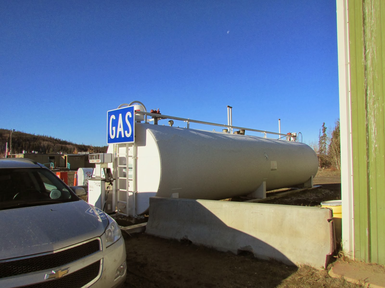
The Yukon River crossing is at Milepost 56 on the road. There is a large bridge over the Yukon River,
followed by a small camp where you could get something to eat and/or fill up on
gas. Filling up on gas was one piece of
advice we took from everything we read and what the lady at the information
center in Fairbanks had told us. She
recommended we fill up at EVERY opportunity.
Since this was the first gas station we had passed since leaving
Fairbanks over 130 miles ago we topped off.
At $5.19 per gallon we are pretty sure that is the most we have ever
paid in our lives. The car (or is it a
truck? We had a Traverse) took about 8
gallons. We did not buy any food on this
trip up; we instead only went inside to check the place out and to take some
pictures. There was a boarded up window
where several years back a bear had broken in during the winter. When the owners had arrived in the spring to
open up there was a large sleeping grizzly bear inside. The bear had torn the place up inside and the
hallway where he lay became his final resting place. We thought that they might just tranquilize
it and relocate it or something but in Alaska grizzly bears are a way of life
and there are so many of them around that you would likely not get anyone to
come help you relocate it.
 |
| The bear window |
The Yukon River Camp
 |
| View crossing the Yukon River |
After leaving the Yukon River Camp we passed by the Hot Spot
Café where we would have stopped for something to eat but it had already been
closed for the season. Instead we
continued northward towards our next stop at the Arctic Circle. The road remained in pretty good shape,
alternating between very nicely paved road not unlike anything you see in the
lower 48, to rougher sections full of potholes.
Nevertheless we were able to maintain our 50+ mph speed for much of the
way.
 |
| Closed Hot Spot Cafe |
We stopped for our obligatory Arctic Circle picture. How many people can say they’ve driven not
only to but north of the Arctic Circle? The
Arctic Circle was the first place we saw other travelers besides trucks and
maintenance vehicles. As we were there
taking our pictures another car pulled up filled with a few Japanese
tourists. We learned that they too had
started that morning in Fairbanks. We
did not learn how far north they were travelling but we did end up leaving
before them.
 |
| A grouse in the trees near the Arctic Circle |
We continued onward.
By now there was more snow around us.
While it wasn’t deep, it was there.
The road was mostly clear but the mix of fall colors with the snow all
over the place made for some pretty nice shots.
We stopped a few more times at various pull offs admiring the truly
amazing scenery before arriving at the first of the 3 towns on the highway,
Coldfoot.
 |
| Don't let the lack of tire tracks throw you off...this is a side road from the highway, not the actual highway |
 |
| One of the paved sections of road |
 |
| And an unpaved section of road |
 |
| The highway and the pipeline in the background |
Coldfoot, at MP 175 of the
Dalton, was 60 miles beyond the Arctic Circle.
It is a former gold mining town that exploded to a big town of 450
people or so during the construction of the pipeline in the 70’s. Today there are 13 people who live
there. Coldfoot was the second and last
available gas on the Dalton as well.
Because we were only travelling another 20 miles or so beyond Coldfoot
we decided not to fill up until the next day.
We did stop to check the place out.
There isn’t much: a small post office only open 3 days a week, a gas
station, a saloon, a hotel (if you want to call it that…more like a place to
sleep). Basically it was a glorified
truck stop. Upon leaving Coldfoot they
warn you of the lack of services for the rest of the Dalton and they also
advise you of restrictions when you get to the end. We think it was then that we started kicking
ourselves for not driving the whole distance.
 |
| The facilities at Coldfoot |
 |
| Coldfoot Post Office |
Our last stop of the day would be in Wiseman. The highway between Coldfoot and Wiseman was
in excellent condition, having apparently been paved in the last year or
so. Wiseman, 3 miles off the Dalton at
MP189 is another tiny little town. It
was also established as a gold mining town in the early 1900’s but today is
nothing more than a handful of houses. Our
stats for the trip between the start of the Dalton Highway and Wiseman: 189 miles.
We passed only 36 vehicles in the other direction, 22 of them being big
rig trucks, 1 being a snowplow and most of the others being maintenance
vehicles that seemed to be patrolling the highway. We saw 5 vehicles travelling in the same
direction as us, most of them being while we were stopped at pull offs. We actually passed 1 person walking on the
road, we did not stop because he waved at us (didn’t seem to be in trouble)
plus there was never a broken down vehicle anywhere. Those stats show you how remote the road is.
 |
| One of the 22 trucks we passed |
In Wiseman there are several cabins and other lodging
available for travelers, we assume this is how people there make a living. We had reservations at the Boreal Lodge,
which had several cabins available as well as a lodge with a few rooms. We had two rooms in the lodge for the 4 of
us. We shared 2 bathrooms and we shared
a kitchen. We were alone the first night
but the second night we shared our kitchen and bathrooms with a couple from
Oregon. We were pleasantly surprised by
how nice the place was, as we were expecting something very rustic. The shared bathrooms and kitchen may sound
rustic but they were very clean. We were
very comfortable and quite happy with our home for the two days.
 |
| The Lodge |
 |
| Shared kitchen |
 |
| One of the two shared bathrooms and showers |
We even had clear weather so we figured we
might get lucky on the Northern Lights.
Our host told us that they had been seeing the Northern Lights on clear
nights between 11 PM and 3:30 AM. We did
our very best to stay awake until then. We alternated between staying awake and taking
naps and we were able to stay awake long enough to check out the sky. We think we got a quick glimpse of the
Northern Lights before it clouded up about 10 minutes after we went outside. We kept checking every 15 minutes for the
next 3 hours or so and it never did clear up again. Now we have another reason to return.
The next day we awoke to very different weather. While Tuesday had been clear and quite
beautiful, Wednesday it was snowing. It
wasn’t snowing hard but it was snowing enough to make it a little
slippery. We were not driving back to
Fairbanks until Thursday but we did plan on driving about 50 miles north of
Wiseman for one specific purpose: To
visit the North Slope Borough of Alaska.
We have already been to all 50 states so we needed a new goal. We are trying to visit every county in the
USA (3142 counties). Alaska has boroughs
instead of counties and the North Slope Borough is one of the more difficult
boroughs in Alaska to reach so being only 50 miles away, we had to go for it. The trip again was pretty easy. Besides being
a little slippery, it was not as much of a roller coaster ride as the day
before. Tuesday’s trip had lots of ups
and downs in the road, Wednesday was mostly flat. The first 20 miles or so were newly paved
making for a smoother ride than most places back home. With just about no traffic we were able to
drive pretty quickly despite the snowy roads.
Near the border of the North Slope Borough we also spotted the furthest
north spruce tree on the highway. We
learned that near our turnaround point was the tree line. Basically that means
that north of that point, trees just do not grow. Our turnaround point was also the start of
probably the most treacherous part of the road, where the road climbs over a
4700 foot high pass. While we didn’t
drive over the pass we did get a picture at one of the pull offs of what the
road looked like in the early days of the highway. We vowed to travel the rest of the road the
next time we visit Alaska.

 |
| Wednesday's scenery...quite different |
 |
| Road conditions on Wednesday |
 |
| The highway over the pass in the early days (1970's). |
We drove back to Wiseman, passing by the town on the way
down so we could buy gas at Coldfoot before heading south the next day. The snow made for a very different scene than
the previous day, but the town was still just as quiet as the previous
day. We returned to Wiseman, walked
around town a little bit and returned to our room to get some sleep because we
would be on clear sky watch again that night hoping for a break in the clouds
that would never come.
 |
| Coldfoot on Wednesday |
 |
| Filling up. $5.19/gallon again. |
 |
| The road leading to our lodge. Like just about every remote Alaska town there is a small airstrip, thus the airplane. |
 |
| Just outside our lodge |
 |
| Another shot of the lodge |
On Thursday we got another early start, this time we were on
the road by 7 AM. We knew how long the
trip should take but we also knew it was snowing and likely would be snowing
the whole way. Before leaving the lodge
we checked on the road conditions for the trip back because as part of our
rustic experience we also had free Wi-Fi.
Chris noted that for part of the trip back they were recommending chains
for your tires, which of course we did not have. We would just have to take it easy. The traffic going home was about as heavy as
the traffic coming up. We saw only 46
vehicles the whole way, but this time 3 of them were snowplows! We think every single truck had chains on
their tires and we also noticed that the trucks, which yesterday were all barreling
down the road at 60 mph+, were today mostly taking it easy. The snow also made for some really nice
scenery going down. It was quite a
difference between Thursday being snowy and Tuesday when it was mostly
clear.


 |
| The car after 100 miles of driving through the snow |
 |
| What a difference only 2 days makes.. |
We stopped again after 130 snowy
miles, at the Yukon River crossing, this time we did not fill up on $5.19 gas
but we instead got some nice pieces of pie inside the café. After eating our pie we continued
onward. As for driving conditions, Chris
noticed that driving on snow covered pavement was slippery but driving on snow
covered dirt road was not slippery at all.
We wished they hadn’t paved that road!
The snowy roads quickly turned into mud the further south we got. Driving on muddy roads was far more slippery
than driving on icy or snowy roads and it made for a very dirty car. We had to stop several times to clear off the
windshield by hand (windshield wiper fluid up front broken: long story). The back of the car further
north was completely covered in snow but now it was completely covered in
mud. Many years ago on a trip for work,
Chris and a friend had an agreement that the person who had the muddier car must
have had more fun on the trip. Chris won
back then with the muddier car but that mud back then was no match for
today. We have no idea how the car
rental company is going to get this car cleaned.
 |
| Yukon River Camp Cafe |
 |
| The end of the highway |
 |
| We had been using the rear windshield wipers to keep the window clean but we found that every minute or so it looked like this again. |
 |
| Looking out the back window from the inside. |
We made it back to Fairbanks a little before 3. We again hit the Walmart, this time to return
our fix-a-flat that we didn’t get to use as well as our bear spray that we
thankfully did not use. We then checked
into our hotel a little after 3.
Next time we’ll make it to the Arctic Ocean…